June 2023 / PADDLING
Leaving Long Pond and entering the channel to Pink Pond. Rich Macha
Map by NYSDEC: www.dec.ny.gov
St. Regis Canoe Area Made Easy
By Rich Macha
Located a few miles northwest of the village of Saranac Lake, the St. Regis Canoe Area covers over 18,000 acres and is the only designated canoe area in New York. There are over 50 motorless ponds of various sizes within the St. Regis and you can find 70 designated primitive campsites spread out over 20 of those ponds – note that camping is limited to eight persons per site. Marked portages, or “carries” as they are known in the Adirondacks, of varying lengths and difficulty connect many of the ponds.
Historically significant routes like the “Route of the Seven Carries” and the “Route of the Nine Carries” can be moderately strenuous to very strenuous affairs, especially when you are loaded with camping gear. But there are easier ways to experience the beauty of the area, whether you choose to visit as a day trip or on an overnighter.
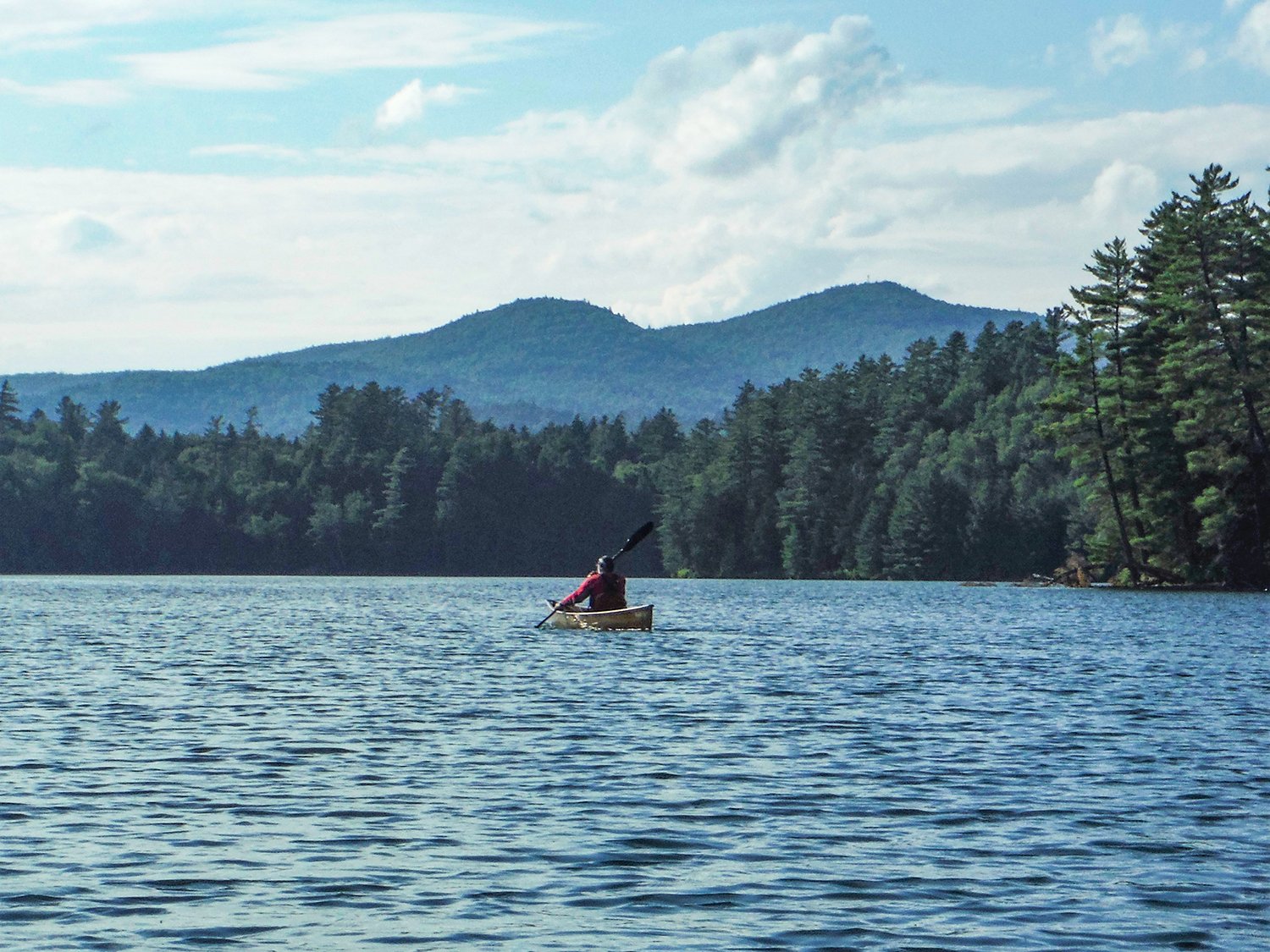
Long Pond and Long Pond Mountain. Rich Macha
Little Clear Pond. Rich Macha
Little Clear Pond
If you only have a day to get a taste of the St. Regis Canoe Area, then a paddle around Little Clear Pond can make for a good introduction. You will be able to enjoy crystal clear waters, rocky points, islands and several miles of wild shoreline, while getting a good view of St. Regis Mountain and witnessing the sights and sounds of the common loon.
The put-in is located at the end of a short drive on a dirt road that leads off Fish Hatchery Road. A sandy beach makes for an easy launch as well as a potential spot for a swim before or after your excursion – however, I have personally stopped swimming here since the time I spotted a leech in the water a number of years ago. Camping and fishing are not allowed on Little Clear due to the waters being associated with the nearby fish hatchery. Technically, the southern shoreline is not actually in the SRCA but that fact doesn’t lessen its attractiveness.
Little Clear Pond and St. Regis Mountain. Rich Macha
From the put-in, it is about 1.5 miles to the pond’s northern end if you paddle directly, but you can cover close to five miles by paddling around its circumference. At the northern end of the pond, there are carry trails to St. Regis, Green and Grass ponds, where you can stretch your legs and walk unencumbered by the weight of your craft and get a peek at some of the other ponds in the area. Perhaps, maybe next time you will be tempted to venture further into the canoe area. West of the carry to St. Regis Pond is a bog/marsh that may also be worth spending some time exploring by boat.
Hoel Pond to Pink Pond
You won’t find too many places where you can paddle five ponds and only have to carry 0.2 miles between them. This can be done as an in-and-out daytrip with 0.4 miles of carries, a one-way through trip with 0.45 miles of carries, or as a backcountry camping trip.
To get to the put-in on Hoel Pond, you turn off Floodwood Road and, as strange as it may seem, drive through a golf course before making a left at the edge of the woods on a somewhat bumpy dirt road. Again, we have a sandy beach to launch from, and fortunately, the swimming in the sandy-bottomed shallows of the pond has so far been leech-free. Hoel Pond is not within the SRCA – the east shore has some private camps but the rest of the shore is state land and is part of the Saranac Lakes Wild Forest. Afternoon winds can produce some chop on this pond so it is wise to get an early start. Motorboats are allowed on Hoel but seldom seen.
The culvert between Hoel and Turtle ponds. Rich Macha
It is a one-mile paddle, with views of St. Regis and Long Pond mountains, to Hoel’s northwest corner where you might notice a large culvert and, to its right, the start of the short carry up and over an old railroad bed to Turtle Pond where you will be officially within the canoe area. Alternately, you can line your canoe or kayak through the culvert – just remember that there will be a one-foot drop onto shallow rocks on the other side which may not be too friendly to the hulls of ultralight composite boats.
You paddle northwest on Turtle for under one-mile and enter a shallow channel that leads into Slang Pond – you may have to get out and ‘line your canoe’ especially if it is heavily laden with camping gear. A short paddle along Slang’s south shore soon leads to the 0.2-mile carry to Long Pond. The carry trail is relatively smooth and flat so a portage cart will work, however, there may be some mud along the way to slow you down.
On the carry between Slang and Long ponds. Rich Macha
A pleasant sandy beach is at the Long Pond end of the carry and, once again, you could be tempted to go for a swim at this scenic spot. On a map, Long Pond looks like a backward “t” and is big enough that you could paddle its shoreline for hours on end. In its western lobe, there is a 1.6-mile hiking trail that takes you up Long Pond Mountain where there are spectacular views of the ponds within the canoe area, and of the High Peaks in the distance.
Paddling south then southwest on the long arm of the pond leads past campsites and an island. A little northwest of the island is the opening to the 0.25-mile lily pad –filled channel that leads into Pink Pond, a small but attractive pond with some steep forested shores as well some boggy shoreline. Another narrower channel leads to Little Pink Pond but there may be a beaver dam or two to lift over along the way. Look for rose pogonia, a showy pink/purple orchid, growing in the boggy areas.
Through-trippers can carry 0.25 miles from Long Pond to the nearest parking area on Floodwood Road and shuttle back to the start. Otherwise, you can return to Hoel the way you came, or do some more exploring off the main route. In late June of last summer, a small group of us went from Hoel to Pink and back to Hoel in a little over 6 hours while traveling over a distance of 11 miles. We saw several loons during our paddle, and the little pink flowers of sheep laurel were in bloom and especially abundant on Slang Pond.
The St. Regis Canoe Area has lots to offer the paddler and adventurer – wilderness camping, swimming, hiking, peace and tranquility, loons and other wildlife, and nature study. The best map for the area is the Adirondack Paddler’s Map – Close-up Series: St Regis Canoe Wilderness. More info and a map can be found on the NYSDEC website: dec.ny.gov/lands/70572.html.
Little Clear Pond. Rich Macha
A lover of wild places, Rich Macha has led many trips for the Adirondack Mountain Club, and has spent 20 years in the paddle/snowsport business. More of Rich’s adventures can be found at northeastwild.blogspot.com.