September 2023 / KAYAK, CANOE & SUP
The author plays in fast water at the falls near Peebles Island. Alan Mapes
Favorite Paddling Places
By Alan Mapes
One of my greatest joys in paddling is exploring new paddling waters. We are blessed with many great places for canoeing, kayaking and paddleboarding around the Greater Capital Region. There are too many for just one article. For this installment, let’s go north to south along the Hudson River with my personal favorites. I’m sure that I’ve left out favorites of some other paddlers and I hope to hear some suggestions from readers. I will leave it to your own resourcefulness to look up specific directions to these launches.
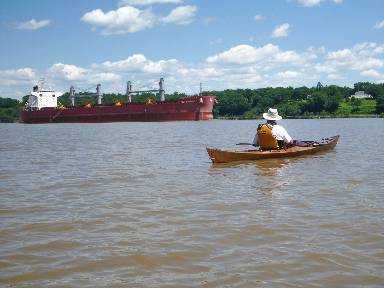
As always, a word of caution is in order. The Hudson is a big river, with power boats ranging from jet skis to ocean-going freighters. Winds, waves and currents can present a challenge, and the tide range of four feet will dry out paddling areas at times. Always wear your life jacket, and paddle with some knowledgeable people if you are not familiar with river conditions.
The author plays in fast water at the falls near Peebles Island. Alan Mapes
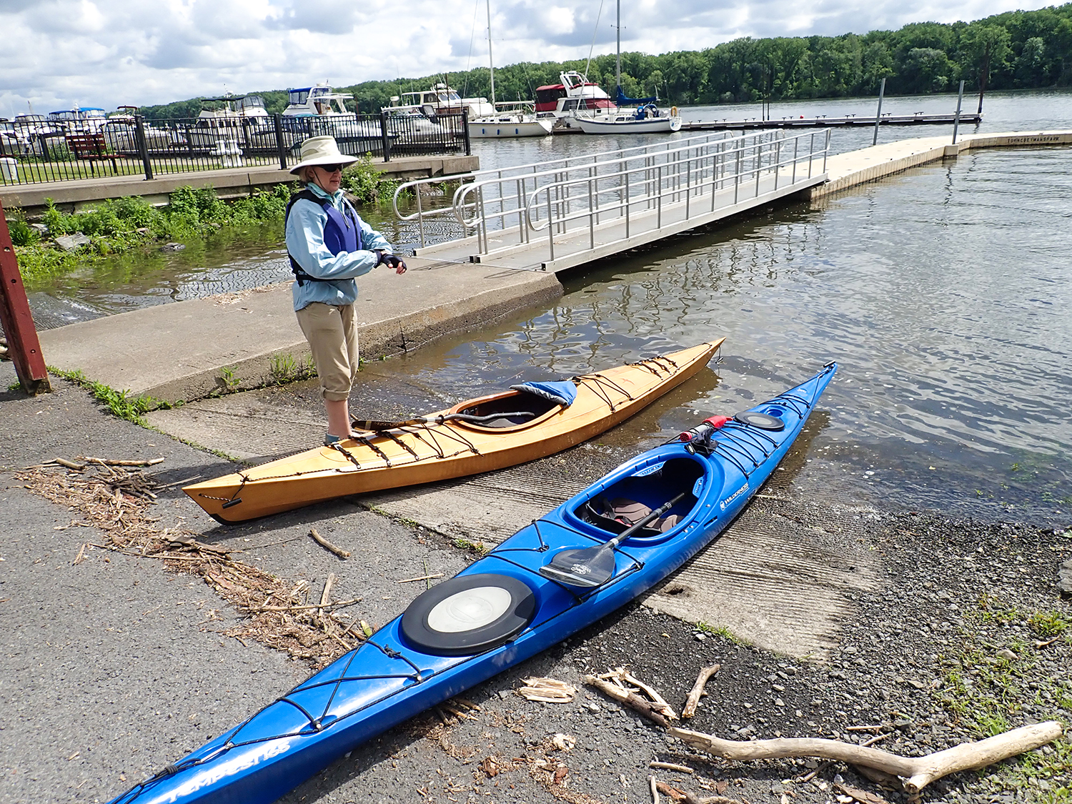
Waterford – The Mohawk and Hudson rivers meet right at the launch on the south end of First Street in Waterford. Or at least a main channel of the Mohawk meets there. Poking around this area with paddle in hand, you will find that the Mohawk splits into three channels near its end. The Waterford launch sits at the end of the northern channel, and is the entrance to the Erie Canal.
In fact, one paddling route here is to take your kayak or canoe through the Waterford Flight of Locks – the eastern end of the Erie Canal. I’ve done it and it’s interesting, but it involves a lot of sitting and waiting for locks to fill and open. Going through five locks in just over a mile, you rise by 165 feet, the greatest lift for the shortest distance of any lock system in the world. A landing at Flight Lock Road, just west of the locks, is a convenient takeout spot for this trip.
From Waterford launch, I like to head south around the nearby tip of Peebles Island State Park (0.2 miles away), and into the middle channel of the Mohawk. This channel winds through calm waters along the steep shore of the park, and to a pool and waterfall. The brave can play in the fast water at the base of the falls, if the flow is not too strong. Back on the Hudson and a mile or so further south, you will find the southern channel of the Mohawk and you can take a nice paddle up that one until you run out of water depth.
Two other routes are fun here – paddling about three miles north from the launch, you can paddle around Campbell Island, just below Lock One of the Champlain Canal. Watch for shallows and fast currents at the north end of the island. You can also paddle south from the launch, staying on the main river for about two miles, where you will come to the Troy Dam and the Federal Lock that marks the northern end of the tidal Hudson River.

ADK paddlers on Papscannee Creek. Alan Mapes

ADK paddlers on the Hudson near the Berkshire Spur Bridge. Alan Mapes
Henry Hudson Park – When my wife and I started kayaking back in 2000, this park was our first go-to paddling spot. More recently, the state has placed a nice boat launch at the north end, good for both trailered power boats and our hand launched boats. The town also installed a special kayak launch, just inside the mouth of the Vlomankill stream on the south end of the park. From the park, you can paddle north on the river to Van Wie’s Point and the port of Albany, or south to the NYS Thruway Berkshire Spur bridge, Schodack Island State Park and Coeymans Landing.
Our favorite is to go straight across the river and paddle up the Papscanee Creek. The creek and its wetlands are said to be the largest tidal wetland area on the Hudson Estuary, and you can paddle nearly two miles up that creek.
Caution: playing the tides here is tricky. To avoid the old break wall at the entrance to the creek, it’s best to go near the time of high tide. The pitfall, though, is the second bridge you come to on the creek. The first bridge is the railroad and has lots of head room for paddlers. The second bridge is just the steel beams and pilings from an old access road, and the head room to paddle under it can disappear at the highest part of the tide. If you find the head room is minimal and water is still flowing into the wetland, don’t go further. You may not have clearance to get out again until the tide falls an hour or two later (don’t ask how I know). At Papscanee, look for a bald eagle’s nest near the mouth, marsh wrens nesting in the cattails, and six-foot-tall plumes of wild rice growing along the waterway.
Char Mapes explores the Hannacroix Creek near Coeymans Landing. Alan Mapes
Preparing to launch at Coeymans Landing. Alan Mapes
Coeymans Landing – Getting my favorite lady out paddling requires the promise of good food afterward. Coeymans is the perfect location, with the marvelous Yanni’s Too waterfront dining establishment – open for their 25th season – right next to the boat launch. From this launch, we like to paddle south, entering the bay about a half-mile on the right, and going up the Hannacroix Creek as far as the high tide will allow. Continuing south along the western shore, we watch out for the concrete breakwater as we exit the bay.
Next is Donovan’s Shady Harbor Marina with its huge cabin cruisers tied up at docks and their waterfront Boathouse Grille with wonderful views from their deck. Paddling a little further, you find a takeout at Cornell Park in New Baltimore village. Go another mile south and you can cross to the southern tip of Schodack Island and a small sandy beach just around the backside of the island. That backside bay goes north about five miles to a kayak landing at the Schodack Island State Park (the bay dries out at low tide). We usually return back north along the shore on the river side of the island.
Paddlers take a break on the Hudson near Coxsackie. Alan Mapes
Ready to launch for a late fall paddle, Coxsackie. Alan Mapes
Coxsackie –This launch and the next one both put you in the area dubbed “eagle central” by a friend. From the revitalized Coxsackie State Boat Launch and Riverside Park in the village of Coxsackie you can paddle either north or south – both directions give you islands, bays and creeks to explore. At least four bald eagle nest sites are found within a five-mile stretch of river here. Next to the park, Patrick Henry’s Waterfront Tavern recently opened in a historic building.
Going north, explore Coxsackie and Rattlesnake islands, and Coxsackie Creek along the west shore. Crossing to the east shore, you find Mill Creek, Stuyvesant village (with a boat launch/landing and Pico de Gallo Mexican restaurant), and Nutton Hook State Unique Area. The largest ice house on the Hudson was located there and the massive brick chimney from the steam plant is a landmark.
Going south, we usually cross to the eastern shore of the river to explore Little Nutton Hook wetland, the landing at Hudson Islands State Park (with boat access campsites), and Stockport Middleground Island. That brings us nearly to our next launch.
Launching after a lunch stop at Stuyvesant. Alan Mapes
Waiting for a big one to pass near Four Mile Point. Alan Mapes
Larry Coklin of Longmont, Color. entering Stockport Creek at the railroad bridge. Alan Mapes
Four-Mile Point Preserve – A short dead-end road south of Coxsackie offers this park by Scenic Hudson with dramatic river vistas, plus the lively Vosburgh Swamp State Wildlife Area (home to many birds and amphibians), and a beach where you can launch kayaks – and enjoy a shoreline picnic.
Directly across the river is Stockport Middleground Island and the mouth of Stockport Creek – with a landing and launch. Going south, you find Stockport Flats State Wetland Preserve on the east side and opposite that, the West Flats Wetlands. Both provide interesting paddling at high tide.
For any of these paddle trips except Waterford, you should consult the tide chart. Why? The direction of flow in the river changes about every six hours. Remember that the Hudson River from Troy to the Atlantic Ocean is a large estuary – a tidal arm of the sea. As tide goes up and down in the ocean, it affects the current direction and the level of water for about 150 miles inland, all the way to the Troy Dam.
The currents in the Hudson are not very fast, usually not more than 1.5 miles per hour in the areas covered in this article. You can successfully paddle against the current, but it’s more work. Add a strong head wind to the current, and it can spell trouble. I check the tides with an internet search on “Hudson River Tide Chart” and the name of a nearby river town, like “Hudson River Tide Chart Coxsackie.”
To learn about safe paddling on big waters like the Hudson, I recommend taking a few trips with a group like the Adirondack Mountain Club or a reputable paddle tour company.
Alan Mapes (alanmapes@gmail.com) is a kayak instructor and guide, certified by the American Canoe Association. He lives near Saratoga Springs and offers kayak instruction through Capital District Kayakers Meetup.